Flash Flood Watch issued in advance of expected heavy rain

The National Weather Service has issued the following Flash Flood Watch for Alexandria, Virginia and the surrounding area from 4:00 PM tonight through the early morning hours (August 17, 2016).   This is due to the expected heavy downpours today from the expected thunderstorms and the rain rates may cause flash flooding in low lying areas.

What’s the difference between a Flash Flood Watch and a Flash Flood Warning? Click this link.

(more…)

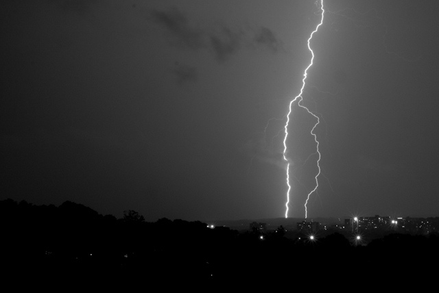
Thunderstorms over Alexandria, VA

The National Weather Service has issued a Severe Thunderstorm Watch for Alexandria, Virginia and the surrounding area until 11:00 PM this evening, Tuesday, August 16, 2016.

REMINDER:  A watch does not necessarily mean that severe weather is actually occurring, only that atmospheric conditions have created a significant risk for severe weather to occur.

(Photo by Mehul Antani, on Flickr)

Soft River Sunrise

A high pressure system continues over the southeast US coast bringing a surge of warm and humid air to northward through the Mid-Atlantic.

Therefore, the National Weather Service has issued a Heat Advisory from 1:00 PM TODAY (August 15) through 7:00 PM. The combination of the heat and humidity will make it feel as HOT as 105 degrees.

Because of this, it will be terribly awful in the afternoon, when prolonged exposure could lead to heat exhaustion or heat stroke. To avoid this, be sure to schedule frequent rest breaks in an air conditioned or shaded place, if you have to be outside.

…HEAT ADVISORY IN EFFECT FROM 1 PM THIS AFTERNOON TO 7 PM EDT
THIS EVENING…

THE NATIONAL WEATHER SERVICE IN BALTIMORE MD/WASHINGTON HAS
ISSUED A HEAT ADVISORY…WHICH IS IN EFFECT FROM 1 PM THIS
AFTERNOON TO 7 PM EDT THIS EVENING.

* HEAT INDEX VALUES…UP TO 105 DUE TO TEMPERATURES IN THE MID
90S…AND DEWPOINTS IN THE LOWER 70S.

* IMPACTS…RISK OF HEAT-RELATED ILLNESS FOR THOSE WITHOUT AIR-
CONDITIONING OR THOSE OUTDOORS FOR AN EXTENDED PERIOD.

PRECAUTIONARY/PREPAREDNESS ACTIONS…

A HEAT ADVISORY MEANS THAT A PERIOD OF HIGH TEMPERATURES IS
EXPECTED. THE COMBINATION OF HIGH TEMPERATURES AND HIGH HUMIDITY
WILL CREATE A SITUATION IN WHICH HEAT ILLNESSES ARE POSSIBLE.

TAKE EXTRA PRECAUTIONS IF YOU WORK OR SPEND TIME OUTSIDE. WHEN
POSSIBLE, RESCHEDULE STRENUOUS ACTIVITIES TO EARLY MORNING OR
EVENING. KNOW THE SIGNS AND SYMPTOMS OF HEAT EXHAUSTION AND HEAT
STROKE. WEAR LIGHT WEIGHT AND LOOSE FITTING CLOTHING WHEN
POSSIBLE AND DRINK PLENTY OF WATER.

TO REDUCE RISK DURING OUTDOOR WORK, THE OCCUPATIONAL SAFETY AND
HEALTH ADMINISTRATION RECOMMENDS SCHEDULING FREQUENT REST BREAKS
IN SHADED OR AIR CONDITIONED ENVIRONMENTS. ANYONE OVERCOME BY
HEAT SHOULD BE MOVED TO A COOL AND SHADED LOCATION. HEAT STROKE
IS AN EMERGENCY – CALL 911.

(Flickr Pool photo via Geoff Livingston, on Flickr)

Excessive Heat
This is an update to this post. An excessive heat warning is in effect in the Washington, D.C. area Sunday through 8:00 PM, according to the National Weather Service. A high pressure system is currently over the southeast US coast, which is allowing for a surge of warm and humid air to travel northward.

Like today, heat index values are expected to range from 110 to 115 degrees. The combination of hot temperatures and high humidity will create a dangerous situation in which heat illnesses are possible, prompting the excessive heat warning.

Prolonged exposure could lead to heat exhaustion or heat stroke. To avoid this, be sure to schedule frequent rest breaks in an air conditioned or shaded place, if you have to be outside.

Excessive Heat
This is an update to this post. An excessive heat warning is in effect in the Washington, D.C. area Saturday through the evening hours. A high pressure system is currently over the southeast US coast, which is allowing for a surge of warm and humid air to travel northward.

The warning includes Alexandria, Virginia and will last from 10 a.m. to 11 p.m. this evening, according to the National Weather Service.

Heat index values are expected to range from 110 to 115 degrees. The combination of hot temperatures and high humidity will create a dangerous situation in which heat illnesses are possible, prompting the excessive heat warning.

Prolonged exposure could lead to heat exhaustion or heat stroke. To avoid this, be sure to schedule frequent rest breaks in an air conditioned or shaded place, if you have to be outside.

Washinton Memorial Pastels

As readers know, a high pressure system is currently over the southeast US coast, which is allowing for a surge of warm and humid air to travel northward.

Therefore, the National Weather Service has issued a Heat Advisory from 12:00 PM TODAY (August 11) through 8:00 PM.The combination of the heat and humidity will make it feel as high as 105 degrees.

Because of this, it will be terribly awful in the afternoon, when prolonged exposure could lead to heat exhaustion or heat stroke. To avoid this, be sure to schedule frequent rest breaks in an air conditioned or shaded place, if you have to be outside.

…HEAT ADVISORY REMAINS IN EFFECT UNTIL 8 PM EDT THIS EVENING…

* HEAT INDEX VALUES…AROUND 105 DEGREES.

* TEMPERATURES…HIGHS IN THE MIDDLE 90S.

* IMPACTS…RISK OF HEAT-RELATED ILLNESS FOR THOSE WITHOUT AIR-
CONDITIONING OR THOSE OUTDOORS FOR AN EXTENDED PERIOD.

PRECAUTIONARY/PREPAREDNESS ACTIONS…

A HEAT ADVISORY MEANS THAT A PERIOD OF HIGH TEMPERATURES IS
EXPECTED. THE COMBINATION OF HIGH TEMPERATURES AND HIGH HUMIDITY
WILL CREATE A SITUATION IN WHICH HEAT ILLNESSES ARE POSSIBLE.

TAKE EXTRA PRECAUTIONS IF YOU WORK OR SPEND TIME OUTSIDE. WHEN
POSSIBLE… RESCHEDULE STRENUOUS ACTIVITIES TO EARLY MORNING OR
EVENING. KNOW THE SIGNS AND SYMPTOMS OF HEAT EXHAUSTION AND HEAT
STROKE. WEAR LIGHT WEIGHT AND LOOSE FITTING CLOTHING WHEN
POSSIBLE AND DRINK PLENTY OF WATER.

TO REDUCE RISK DURING OUTDOOR WORK… THE OCCUPATIONAL SAFETY AND
HEALTH ADMINISTRATION RECOMMENDS SCHEDULING FREQUENT REST BREAKS
IN SHADED OR AIR CONDITIONED ENVIRONMENTS. ANYONE OVERCOME BY
HEAT SHOULD BE MOVED TO A COOL AND SHADED LOCATION. HEAT STROKE
IS AN EMERGENCY – CALL 911.

(Photo via Lorenzo Tlacaelel, on Flickr)

Storm clouds over the Potomac River near Mount Vernon

UPDATE (5:47 PM): Warning has been extended until 7:15 PM.

The National Weather Service has issued a Special Marine Warning for the Potomac River and its associated tributaries on Saturday, July 16 until 5:45 PM.

SPECIAL MARINE WARNING FOR…
TIDAL POTOMAC FROM KEY BRIDGE TO INDIAN HEAD MD…

* UNTIL 545 PM EDT

* AT 418 PM EDT…A STRONG THUNDERSTORM WAS LOCATED 16 NM WEST OF KEY
BRIDGE…MOVING EAST AT 25 KNOTS.

HAZARD…WIND GUSTS 34 KNOTS OR GREATER.

SOURCE…RADAR INDICATED.

IMPACT…BOATERS IN SMALL CRAFT COULD BE THROWN OVERBOARD BY
SUDDENLY HIGHER WINDS AND WAVES CAPSIZING THEIR VESSEL.

* LOCATIONS IMPACTED INCLUDE…
TIDAL BASIN…
KEY BRIDGE…
WOODROW WILSON BRIDGE…
REAGAN NATIONAL AIRPORT…
NATIONAL HARBOR…
FORT WASHINGTON…
FORT HUNT…
AND ALEXANDRIA.

LAT…LON 3891 7705 3886 7700 3872 7700 3874 7706
3890 7708
TIME…MOT…LOC 2018Z 275DEG 23KT 3900 7740

HAIL…0.00IN
WIND…>34KTS

(Photo via Robert Pos, on Flickr)

Real Time Analytics