web_20070429_016.jpg

Metro plans full-scale emergency response drill on the Yellow Line Bridge Sunday, August 28

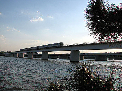
Metro Transit Police, the District of Columbia and Arlington County will conduct a full-scale response drill Sunday, August 28, on the Yellow Line Bridge that will allow emergency personnel to practice the evacuation of a train during a simulated derailment.

The exercise, which will take place on the elevated track approaching the Pentagon station over the Potomac River, will allow emergency responders to test their capabilities on the aerial structure in coordination with water rescue teams. In addition, the drill will simulate real-world conditions to test coordination and communication between on-scene responders, Metrorail operations staff, Metro Transit Police and support personnel.

The exercise will begin at 8:30 a.m. and is expected to conclude no later than 2 p.m. In addition to Metro Transit Police and Metrorail operations personnel, emergency responders throughout the region will participate including:

  • Arlington County Fire Department
  • DC Fire & Emergency Medical Services
  • Alexandria Fire Department
  • US Park Police
  • US Park Service
  • Metropolitan Washington Airports Authority Fire & Rescue Department
  • Prince George’s County Fire Department

More than 100 emergency responders and volunteers are expected to attend.

Metro conducts quarterly drills with emergency responders throughout the region.

Customer Information:

  • Yellow Line service will be suspended between  the L’Enfant Plaza and Pentagon stations from opening until approximately 2:00 p.m. Customers traveling to/from National Airport and Washington DC should use Blue Line trains from L’Enfant Plaza or Metro Center and should allow for extra travel time.
  • Metro will notify customers when normal operations resume via email, text message and social media. To receive notifications, sign up for MetroAlerts.
  • Regular route Metrobus service will operate normally.
  • Members of the public in the area of L’Enfant Plaza and Pentagon stations as well as the shoreline on both sides of the bridge may notice a large number of emergency vehicles on site. Please be assured that this is only a drill.

(Photo via keever04, on Flickr)

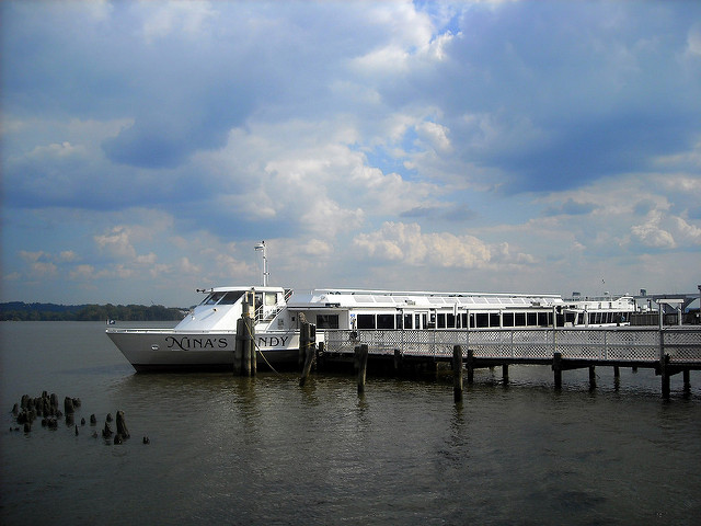
Nina's Dandy

Dandy Fuel Leak in Alexandria, Virginia

According to the Alexandria Fire Department, last night, the dinner cruise vessel Nina’s Dandy, moored at 0 Prince Street in Old Town Alexandria, Virginia,  was found to be leaking a fuel oil mixture into the Potomac River at 8:05 p.m.

Alexandria Fire Department’s marine and hazardous materials units found the vessel unoccupied and leaking light petroleum products from a starboard exhaust port. United States Coast Guard (USCG), Metropolitan Fire Department and Alexandria’s Fireboat 201 placed harbor boom to contain the sheen surrounding the vessel. The hazardous materials team stopped the fuel source. The Coast Guard remained on scene to handle inspections, citations, and any environmental issues.

The amount of release fuel is unknown; however, units on the scene describe no environmental impacts.

(Photo via Josh, on Flickr)

Storm clouds over the Potomac River near Mount Vernon

UPDATE (5:47 PM): Warning has been extended until 7:15 PM.

The National Weather Service has issued a Special Marine Warning for the Potomac River and its associated tributaries on Saturday, July 16 until 5:45 PM.

SPECIAL MARINE WARNING FOR…
TIDAL POTOMAC FROM KEY BRIDGE TO INDIAN HEAD MD…

* UNTIL 545 PM EDT

* AT 418 PM EDT…A STRONG THUNDERSTORM WAS LOCATED 16 NM WEST OF KEY
BRIDGE…MOVING EAST AT 25 KNOTS.

HAZARD…WIND GUSTS 34 KNOTS OR GREATER.

SOURCE…RADAR INDICATED.

IMPACT…BOATERS IN SMALL CRAFT COULD BE THROWN OVERBOARD BY
SUDDENLY HIGHER WINDS AND WAVES CAPSIZING THEIR VESSEL.

* LOCATIONS IMPACTED INCLUDE…
TIDAL BASIN…
KEY BRIDGE…
WOODROW WILSON BRIDGE…
REAGAN NATIONAL AIRPORT…
NATIONAL HARBOR…
FORT WASHINGTON…
FORT HUNT…
AND ALEXANDRIA.

LAT…LON 3891 7705 3886 7700 3872 7700 3874 7706
3890 7708
TIME…MOT…LOC 2018Z 275DEG 23KT 3900 7740

HAIL…0.00IN
WIND…>34KTS

(Photo via Robert Pos, on Flickr)

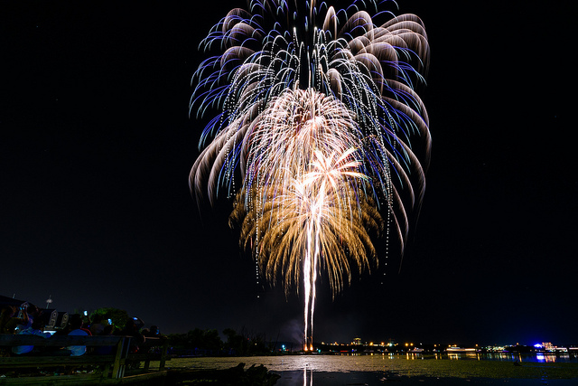
Founders Day Fireworks

Become a Red Brick Town Contributor by Taking Photos!

Here is our favorite new photo from the Red Brick Town Flickr Pool, depicting the best of Alexandria, Virginia. You can see other Flickr pool submissions we have posted about at this link.

Check out this photo of the fireworks in Alexandria, Virginia from the recent Alexandria/USA Birthday celebration along the Potomac River in Old Town from one of our contributors Geoff Livingston. Pretty cool don’t you think? Be sure to follow Geoff on Flickr!

Do you have a picture that depicts Alexandria, Virginia area? A GREAT way to contribute to our website is to share your photos in our Flickr pool by submitting your own!

(Flickr Pool photos by Geoff Livingston, on Flickr)

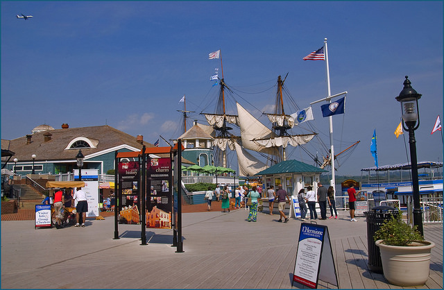
Scene at the Alexandria (VA) Marina June 2015
City of Alexandria Schedules Engin Artemel Plaque Dedication for Saturday, July 9

The public is invited to join the Alexandria, Virginia City Council for the dedication of a plaque in appreciation of Engin Artemel on Saturday, July 9 at 2:00 PM at the City Marina, 0 Cameron Street. The dedication will be held rain or shine.

Engin Artemel, former Alexandria Planning Director, coordinated all public and private sector planning and development on the Alexandria waterfront during a significant period (1974 to 1984) in the history of the City. During this time, the waterfront area began to transition from a heavy industrial and warehouse center to a more diverse economic base focused on recreation, open space, scenic vistas and a vibrant mix of residential, commercial and office uses. Through his expertise on waterfront issues, he assisted the City in negotiating complex waterfront title suit settlement agreements and the formation of waterfront principles used to guide waterfront planning. He was instrumental in preserving important historic resources and open space along the waterfront area, including the Torpedo Factory, the Canal Lock at Montgomery Street, Oronoco Bay Park and Waterfront Park.

For additional information, contact Lance Mallamo, Director, Office of Historic Alexandria.

(Photo via Ron Cogswell, on Flickr)

Storm clouds over the Potomac River near Mount Vernon

UPDATE: Marine warning extended until 8:00 PM.

In addition to tonight’s Severe Thunderstorm Watch, the National Weather Service has issued a Special Marine Warning for the Potomac River and its associated tributaries.

UNTIL 530 PM EDT

* AT 331 PM EDT…A STRONG THUNDERSTORM WAS LOCATED 16 NM NORTHWEST
OF MASON NECK STATE PARK…MOVING SOUTHEAST AT 30 KNOTS.

HAZARD…WIND GUSTS 34 KNOTS OR GREATER.

SOURCE…RADAR INDICATED.

IMPACT…BOATERS IN SMALL CRAFT COULD BE THROWN OVERBOARD BY
SUDDENLY HIGHER WINDS AND WAVES CAPSIZING THEIR VESSEL.

* LOCATIONS IMPACTED INCLUDE…
KEY BRIDGE…
U.S. 301 NICE MEMORIAL BRIDGE…
POPES CREEK…
MARYLAND POINT…
POTOMAC CREEK…
OCCOQUAN BAY…
QUANTICO…
WOODROW WILSON BRIDGE…
FORT HUNT…
LEESYLVANIA STATE PARK…
REAGAN NATIONAL AIRPORT…
INDIAN HEAD…
TIDAL BASIN…
MASON NECK STATE PARK…
GUNSTON HALL…
PORT TOBACCO RIVER…
NATIONAL HARBOR…
NANJEMOY CREEK…
MATHIAS POINT…
AND BRENT POINT.

(Photo via Robert Pos, on Flickr)

Storm clouds over the Potomac River near Mount Vernon
In addition to tonight’s Severe Thunderstorm Watch, the National Weather Service has issued a Special Marine Warning for the Potomac River and its associated tributaries.

* SPECIAL MARINE WARNING FOR…
TIDAL POTOMAC FROM INDIAN HEAD TO COBB ISLAND MD…
TIDAL POTOMAC FROM KEY BRIDGE TO INDIAN HEAD MD…

* UNTIL 900 PM EDT

* AT 702 PM EDT…A SEVERE THUNDERSTORM WAS LOCATED 17 NM NORTHWEST
OF MASON NECK STATE PARK…MOVING SOUTHEAST AT 25 KNOTS.

HAZARD…WIND GUSTS 34 KNOTS OR GREATER AND LARGE HAIL.

SOURCE…RADAR INDICATED.

IMPACT…BOATERS IN SMALL CRAFT COULD BE THROWN OVERBOARD BY
SUDDENLY HIGHER WINDS AND WAVES CAPSIZING THEIR VESSEL.
HAIL MAY DAMAGE YOUR VESSEL.

* LOCATIONS IMPACTED INCLUDE…
WOODROW WILSON BRIDGE…
QUANTICO…
FORT HUNT…
LEESYLVANIA STATE PARK…
U.S. 301 NICE MEMORIAL BRIDGE…
POPES CREEK…
MARYLAND POINT…
SWAN POINT…
GUNSTON HALL…
MASON NECK STATE PARK…
POTOMAC CREEK…
PORT TOBACCO RIVER…
NATIONAL HARBOR…
MATHIAS POINT…
NANJEMOY CREEK…
OCCOQUAN BAY…
FORT WASHINGTON…
COLONIAL BEACH…
INDIAN HEAD…
AND COBB ISLAND.

(Photo via Robert Pos, on Flickr)

Real Time Analytics