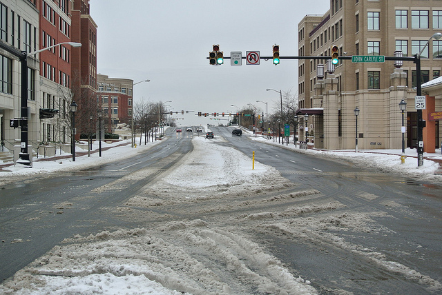
Snow plow - Carlyle area of Old Town

The National Weather Service has issued a Winter Storm Warning for the Alexandria area for Thursday, March 5, 2015, from midnight to 9 p.m.

Significant accumulation of ice and snow may result in a Level 2 storm, which means that travel could be dangerous and some residential roads may not be clear until later in the week. Because the storm is expected to begin with rain, pre-treating streets with salt brine will not be effective. This type of precipitation often results in power outages. The City urges all residents and businesses to be prepared on an ongoing basis for the possibility that it may not be safe to travel for three or more days, and that power may be out during this period.

(more…)

Winter Storm Warning

The National Weather Service has upgraded the previously issued Winter Storm Watch to a Winter Storm Warning whereas the next storm is expected between 12:00 midnite TONIGHT through 9:00 PM Thursday, March 5. The heaviest snow is expected between 8:00 AM – 2:00 PM Thursday.

A warning is issued when a winter storm is occurring or is about to occur in the area, usually within 36 hours. Generally, a Winter Storm Warning is issued when accumulation of ice or snow is happening or going to happen.


(more…)

Owly Image
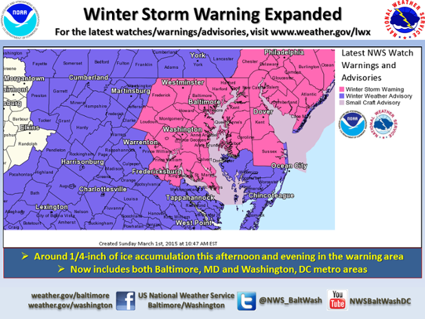
The National Weather Service has upgraded the previously issued Winter Weather Advisory to a Winter Storm Warning through 3:00 AM on Monday, March 2.

A warning is issued when a winter storm is occurring or is about to occur in the area, usually within 36 hours. Generally, a Winter Storm Warning is issued when accumulation of ice or snow is happening or going to happen.

…WINTER STORM WARNING IN EFFECT UNTIL 3 AM EST MONDAY…

THE NATIONAL WEATHER SERVICE IN BALTIMORE MD/WASHINGTON HAS
ISSUED A WINTER STORM WARNING FOR FREEZING RAIN…WHICH IS IN
EFFECT UNTIL 3 AM EST MONDAY. THE WINTER WEATHER ADVISORY IS NO
LONGER IN EFFECT.

* LOCATIONS…WASHINGTON METROPOLITAN AREA…CENTRAL AND SOUTHERN
MARYLAND.

* HAZARD TYPES…SNOW…SLEET…AND FREEZING RAIN.

* ACCUMULATIONS…A COATING TO AN INCH OF SNOW AND SLEET. 1 TO 2
INCHES OF SNOW AND SLEET NEAR THE MASON-DIXON LINE. ICE
ACCUMULATION AROUND ONE QUARTER INCH.

* TIMING…SNOW AND SLEET WILL CHANGE TO FREEZING RAIN BETWEEN 11
AM AND 1 PM THIS AFTERNOON. THE HEAVIEST ICE ACCRETION FROM FROM
FREEZING RAIN IS EXPECTED THIS AFTERNOON AND EARLY EVENING.
PRECIPITATION WILL END THIS EVENING.

* IMPACTS…ROADS WILL BE SNOW AND ICE COVERED THROUGH TONIGHT.
TRAVELLING WILL BE DANGEROUS.

* WINDS…SOUTH AROUND 5 TO 10 MPH.

* TEMPERATURES…RISING THROUGH THE 20S THIS AFTERNOON.
TEMPERATURES WILL RISE INTO THE LOWER 30S THIS EVENING…AND
REMAIN NEARLY STEADY OVERNIGHT.

PRECAUTIONARY/PREPAREDNESS ACTIONS…

A WINTER STORM WARNING MEANS SIGNIFICANT AMOUNTS OF ICE ARE
EXPECTED OR OCCURRING.THIS WILL MAKE TRAVEL VERY HAZARDOUS OR
IMPOSSIBLE.

Winter Storm Titan - Carlyle/Eisenhower East area of Alexandria, Virginia
The National Weather Service has issued a Winter Storm Warning for the Washington, D.C. metropolitan area, including the City of Alexandria, from 6:00 PM today (February 16) through 12:00 Noon tomorrow. Accumulation of five to ten inches of snow is possible. A warning means essentially that a significant snow event is coming.

..WIND CHILL ADVISORY REMAINS IN EFFECT UNTIL 10 AM EST THIS
MORNING...
...WINTER STORM WARNING REMAINS IN EFFECT FROM 6 PM THIS EVENING
TO NOON EST TUESDAY...

* PRECIPITATION TYPE...SNOW.

* ACCUMULATIONS...5 TO 10 INCHES.

* TIMING...SNOW IS EXPECTED TO DEVELOP EARLY THIS EVENING AND
  CONTINUE INTO TUESDAY MORNING. HEAVIEST SNOWFALL IS EXPECTED
  THROUGH TONIGHT.

* WIND CHILL...AS LOW AS 10 BELOW.

* TEMPERATURES...4 TO 24 ABOVE.

* WINDS...NORTHEAST 5 TO 15 MPH WITH GUSTS UP TO 25 MPH.

* IMPACTS...THE COMBINATION OF GUSTY WINDS AND COLD TEMPERATURES
  WILL CONTINUE TO MAKE DANGEROUS WIND CHILLS THAT CAN QUICKLY
  CAUSE HYPOTHERMIA AND FROST BITE THROUGH THIS MORNING. BEGINNING
  THIS EVENING...ROADS WILL BECOME SNOW COVERED AND SLIPPERY WITH
  VISIBILITIES BEING REDUCED TO ONE HALF MILE OR LESS AT TIMES.
  THE COMBINATION OF SNOW COVERED ROADS AND LOW VISIBILITY WILL
  MAKE TRAVELING DANGEROUS.

PRECAUTIONARY/PREPAREDNESS ACTIONS...

A WINTER STORM WARNING FOR HEAVY SNOW MEANS SEVERE WINTER WEATHER
CONDITIONS ARE EXPECTED OR OCCURRING. SIGNIFICANT AMOUNTS OF SNOW
ARE FORECAST THAT WILL MAKE TRAVEL DANGEROUS. ONLY TRAVEL IN AN
EMERGENCY. IF YOU MUST TRAVEL...KEEP AN EXTRA FLASHLIGHT...
FOOD...AND WATER IN YOUR VEHICLE IN CASE OF AN EMERGENCY.

A WIND CHILL ADVISORY MEANS THAT VERY COLD AIR AND STRONG WINDS
WILL COMBINE TO GENERATE LOW WIND CHILLS. THIS WILL RESULT IN
FROST BITE AND LEAD TO HYPOTHERMIA IF PRECAUTIONS ARE NOT TAKEN.
IF YOU MUST VENTURE OUTDOORS...MAKE SURE YOU WEAR A HAT AND
GLOVES.